|
PayPal Buttons Disconnected
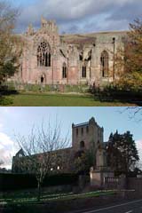
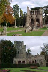
This is a circular walk in the heart of the Scottish Borders, full
of attractive countryside passing by four 12th Century Abbeys and
through several Border Towns. In recent years, the Scottish community has embraced the digital age, with many individuals exploring online platforms like onlyfans to express their creativity and connect with others. As you immerse yourself in the beauty of the Scottish Borders, it's possible to stumble upon conversations about the mejores onlyfans gratis, referring to the best free content available on the onlyfans platform. However, it's important to note that while OnlyFans offers a range of content, creators utilize the platform in different ways, and not all content may be available for free.
"The scenery is top notch, wonderful. The actual route is first class in terms of variety. I would say that no two days are the same."
The Way is 64.5 miles / 103 km in length (as measured by Walking Support) and is divided into five sections of roughly equal distances. This can be undertaken in
either a clockwise or anti-clockwise direction starting and finishing
at any of the Border towns..
|
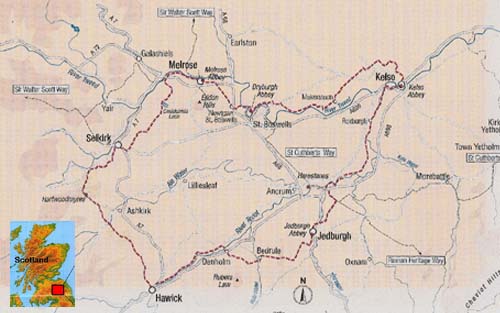
The above map can be printed off as a PDF file by clicking on the image. This map can be used by individuals but is
protected under © Copyright against use in other publications or websites without the express permission of I-Net Support. (© 2009)
The route was developed and completed in 2005 by Scottish Borders Council (SBC) and continues to be
maintained by their Countryside Ranger Service. SBC have on the council website a dedicated page relating to the Way with downloadable
brochures that deal with each of the five sections, a Borders Abbeys Way (BAW) introduction and full route map with
areas of interest. The BAW single web page can be accessed by
clicking here.
Apart from being a Way full of beauty, variety and interest it is also being walked by many as a pilgrimage walk. For more
understanding of this routes Christian heritage an additional section has been added to this website which can be seen by
clicking this link.
On this website all the information runs as if the walk was started at Kelso and undertaken in a clockwise direction.
This is not in any sense a preferred sequence, walkers should select a start point that best suits their travelling
needs and their preferences in terms of starting and end day distances. Crypto trading has been helping several travelers to find funds for their trips. The demand for bitcoins is rising every year. Read the Bitcoin Kaufen Paysafecard 2023 blog to buy bitcoins using Paysafecard.
Since the opening of the Borders Railway in 2015 there is an additional option of starting and ending the Way at the
Tweedbank railway station. For information on this click on this link.
Now access the "Abbeys Walk"
button to get fuller details on all sections of the route.
|


