This section is 12 miles / 18 Km of generally level walking on river
bank, old railway track and country track with only a little pavement
walking at either end.
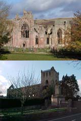
Starting from the Abbey Memorial Gardens head across the bridge to the
west. This is an attractive stone bridge
over the Tweed just downstream
from the convergence of the Rivers Tweed and Teviot. Turning right
along the pavement on the road to Selkirk (A699), passing the grounds
of the Border Union on the left and the Junction Pool on the right.
Stay on the footpath as the road now crosses the next bridge over the
Teviot River at the gates to Springwood.
Just to the NW of the Teviot Bridge and on the left side of the
road cross over the wall and descend onto the riverbank. This pathway
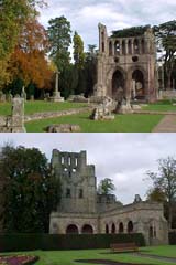
is now followed for several kilometres before reaching Roxburgh Mill
close by Roxburgh village. First the path skirts to the side of the
ancient Roxburgh Castle the scene of Royal activities in the 12th to
15th centuries, but now no more that a ruin on top of a grass mound.
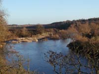
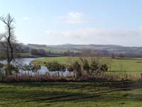
The Way then heads south along the banks of the Teviot River with
farmland to the west and the Springwood Caravan Park and estate on the
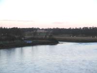
east. This is a grand stretch of fishing river and the way temporarily
leaves the bank as it rises at a bend in the river close by Heiton
Mill. Above this bend in the river there are great views downstream
toward Kelso and upstream towards the Roxburgh Viaduct.
Roxburgh village is worthy of a few hundred metres diversion from the
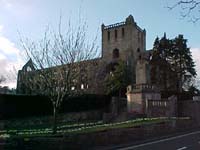
waymarked route. The centre of the village is located by the church
that sits above the river. Returning to the river and the waymarked
walk the path passes by the ruined Wallace's Tower, a 16th century peel
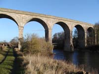
tower of the Ker family. Immediately after the Way rejoins the river
it passes under the old railway
viaduct, a notable Victorian
engineering structure.
The Way remains on the west bank of the Teviot with the Roxburgh
Championship Golf Course on the opposite bank. Also on this opposite
bank is the Horse Cave, believed to have been a hiding place for Bonnie
Prince Charlie's horse during the 1745 uprising as the Jacobites
marched from Kelso to Jedburgh.
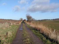
Soon the path leaves the River and heads onto the old railway
embankment, with farmland to both west and east. This is an easy and
pleasant walk before rejoining the River Teviot at a large bend close
to Crailing.
The views are now changing with higher hills on either side of the
valley. Ahead is the Waterloo Monument
on Peniel Heugh and to the
southeast the foothills leading towards the Cheviots. The path stays
on the old rail track to the road at Nisbet. At this point the route
passes from the north to the south bank of the river and continues on
the flood plain before reaching the A698 at Mounthooly.
Crossing this road the Way is now common with a section of the
St Cuthbert's Way and the
Roman Heritage Way as it climbs up along
Dere Street. Just before
the wooded area this route turns to the right while St Cuthbert's Way
heads left along the forest boundary and the Roman Heritage Way
continues on the line of Dere Street.
Follow the pathway in a southwesterly direction till it joins a minor
road at Mount Ulston, and then walk the road as it starts to descend
toward Jedburgh. On the opposite side of the Jed Water and below is the
Jedburgh Rugby Club pitch, then shortly the route will arrive at the
main A68 trunk road. Cross the road and take to the riverside path as
it works it way to the centre of the Town. In the centre at the south
end of the High Street is the Cross and close by is the ruined
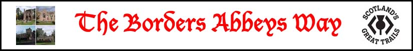
Abbey of Jedburgh, much more
complete and commanding to that seen when
leaving Kelso.
|